Ride Recap: Escape from Bay to Breakers

It turned out not to be much of an escape after all. Getting from the East Bay to Woodside for this ride meant crossing a bridge. And it wasn’t going to be the Bay Bridge since it was the morning of the Original Party-on!-Foot (says Wayne). Seasoned San Franciscans know this is the morning you avoid trying to get across town unless you like to wait for 75,000 drunk and high “runners” to get out of your way. But checking Google Maps before leaving the manse it said the quickest way to Woodside Town Hall was via the Bay Bridge. What?

Against my gut feeling we headed for the toll plaza because Google Is Always Correct. Just the other side of Yerba Buena Island the legions of cars slowed to a molasses-like crawl. “Lane closure” the sign read. This couldn’t be another traffic disaster like yesterday, right? In case you didn’t hear, Caltrans scheduled a closure of the #4 bore of the Caldecott Tunnel for this past Saturday and it didn’t go well. A crash in the #3 bore—the only other westbound bore—meant that traffic backed up all yesterday morning and most of the afternoon since all that “light” Saturday traffic had to funnel down to one lane. I know this because Waze directed hundreds of cars up my street as they frantically tried to escape car hell. Desperate drivers overflowed into Orinda like rats fleeing a burning building. That “lane closure” turned out just to be the far right lane to the Fremont Street exit being closed because Bay to Breakers. This is standard practice every year. It wouldn’t be a biggie except that thousands of drivers insisted upon driving to downtown San Francisco anyway. So they jammed the bridge trying desperately to get into the far left lane to exit at Fremont. What were they thinking?? It’s Bay to Breakers day and the chaos starts downtown! That exit was massively backed up onto the bridge making the whole area a mosh pit of cars. Only after getting past that insane mess did we discover that traffic was actually light on the 101. Seriously, just stay away from San Francisco on Bay to Breakers day.

Things were much better when we arrived in Woodside. It was sunny and warm, so warm I was overdressed in a longsleeved jersey and gilet. As usual for a Sunday, Woodside was packed with cyclists. Our ride was starting so late—10:30 AM—that riders were turning into the Town Hall parking lot because they were finishing their rides! Well, we made the better choice: not only was it warmer but by the time we got to Old La Honda the road was empty. Honestly, like just four or five cars passed us on OLH (all but one being Teslas) and we saw exactly seven other cyclists. There are times riding up OLH you feel like you’re a salmon heading upstream. Along with hundreds of your fellow salmon. But not today—it was quiet, undisturbed. Basically it was awesome having the road all to ourselves.

Old La Honda is, well, old because it goes back to the 19th century when the lumber industry needed roads in the Coast Range. I’m uncertain of the history of La Honda Road, which is also State Highway 84, and of what is now Old La Honda Road. Perhaps the two roads had the same name because they eventually ended (or started) at the town of La Honda. In the 19th century these weren’t public roads anyway. They were logging roads or perhaps toll roads built after logging made the Coast Range more inhabited. In any case what is now Highway 84 became the main road for car traffic probably because it’s wider and less winding than what is now called Old La Honda Road. That was good news for cyclists as cars took 84 to get to and from the coast and to roam up and down Skyline Boulevard leaving Old La Honda as a mostly forgotten byway.

In the late 1960s my high school friends and I would ride our bikes over to the coast on weekends and we usually took Highway 84 instead of Old La Honda because Old La Honda was steeper. We were also on very modest bikes. I was riding a Schwinn Continental, my first ten-speed. This boat anchor of a bike probably weighed well over 30 pounds with its chrome rims, chrome cotter-pin crankset, chrome handlebars, chrome seatpost, and kickstand—basically it was all steel. Oh, and I hadn’t figured out that it would help to have toeclips and straps to get over the hills. And it was a true ten-speed: a “racing” standard 52-42 crank with a five-gear freewheel, probably a 13-28. It wasn’t made for going uphill at least by the feeble (or feeble minded). So Highway 84 involved the least amount of suffering. Also the summit, Skylonda, is lower than the top of Old La Honda. So in all ways it was easier except for the incessant automobile traffic. We did occasionally go up Old La Honda, Kings Mountain, and even Page Mill Road to get to the coast. But they were a lot harder.

Today we were intent on checking out Old La Honda, specifically the west side, because that portion of road had a serious collapse the winter of 2023 resulting in its long term closure. The county wasn’t able to find the money, line up a contractor, and get it repaired until last July. But we hadn’t been back to check out the road since our last club ride through there in 2022. West Old La Honda is nice for avoiding the jam-up at Skylonda and although not essential for the usual loop out Haskins Hill and back Tunitas, it makes it a much more pleasant adventure. It was also a chance to check out the northern section of Skyline Boulevard, which I hadn’t ridden in many a year.

On Sand Hill Road we were passed by two cyclists like we were roadside litter and made the turn onto OLH. That was the theme of the day: we got passed a lot more than we passed anyone.

The climb starts immediately on OLH and continues unabated until you arrive at Skyline about three-and-a-half miles. I was tired and I merely wanted to check out the roads and survive them, not burn them up. I soon dropped into the granny. Although I wasn’t in my lowest gear, I was getting mighty close! Since there was surprisingly little traffic on OLH we had a peaceful ascent. The road is almost entirely shaded by redwoods and pines making it a good choice on hot days. Although it wasn’t hot, the shade was welcome. OLH has an average grade of about 7%. But it often feels a lot worse due to its frequent turning and the gradient increasing in the curves. OLH is in decent shape still. It’s not often repaved and the last chip seal seems to be holding up well. Well, until you get near the top and you see the road becomes one lane and is controlled by a timed stoplight: that portion is collapsing down the slope.

Repair of 2023 road collapse on west Old La Honda

Dropping down west OLH was the objective. Back in the day west OLH was a dirt road. I believe it wasn’t paved until well into the 1980s. At that point I started to use it a lot more since it was a lot less bumpy and rutted. The upper section is looking worn but okay; midway you can see a newer chip seal that’s rather smooth. It wasn’t until about halfway down that we finally saw the repaired collapse. The retaining wall is impressive. Further down it looks like the county also did some patching to the roadway. We encountered just one car heading uphill.

Turning onto Highway 84 to head to Skylonda, you’re in a different world, the world of impatient cars, loud motos, and weekend Ferraris. Highway 84 is adequately wide but the shoulder is often nonexistent. We saw one pickup driver give a downhill cyclist a punishment pass. The cyclist was right up against the edge of the road and the pickup driver leaned on his horn as he roared by. Back in the 1970s the attitude of car drivers was in some ways much worse. There were fewer cyclists and we were viewed as real oddities and there was a lot less awareness about sharing the road. In thinking about that poor cyclist, riding in the gutter was exactly the wrong thing to do. Instead he should have taken the lane and forced the driver to slow down, as he would have gotten the horn anyway.

Fortunately the climb is only about two miles and it’s rather gentle, about 3%. At Skylonda it was the usual mess of motos, cars, and cyclists trying to get through the intersection. Traffic on Skyline has no stop sign so they are typically pedal-to-the-metal, making any crossing an anxious and hurried affair. When you’ve got an expensive and powerful sports car or moto, where can you drive it at full throttle? Skyline Boulevard!

By now I was tired and the climb up Skyline to Skeggs Point is several miles at about 6% or so. We lucked out in that there was surprisingly little traffic traveling on it for a Sunday. I watched Roger inch ahead of me as my legs got slower and slower. If you are planning to ride Skyline, it’s better to ride it in the opposite direction, i.e. from Kings Mountain to Skylonda, rather than the way we did it. A better loop would have been to go up Kings Mountain, then Skyline to west OLH. But then we would have had to descend OLH and that can be sketchy with weaving uphill cyclists sprawled all over the road including in the blind corners because, of course, no sane cyclist goes down OLH! I was relieved to finally arrive at Skeggs Point. Whew, that was a work out!

After Skeggs it’s easy-peasy with a fast drop down to Kings Mountain. From there it was literally all downhill, about six miles of constant descent. Although it was only three years ago since we went down Kings Mountain, a lot can happen to a roadway in that time. So we took it carefully in case we encountered potholes, debris, or a car crossing the centerline. We passed a lot of cyclists heading up the road, all of them slowly. After all that climbing it was a wonderful way to end a ride. Old La Honda is back on the menu again!

The American River Bike Trail

Starting at Discovery Park, May 6, 1984

Three weeks ago Roger and I went up to Sacramento and rode the American River Bike Trail on a Monday. We had been thinking of going up to do it on the weekend. But the weather on Saturday and then Sunday was less than ideal. A weekday would actually be a better day to ride it because there would be less traffic on the trail or so we thought. We thought about listing the ride on the club calendar. However we were indecisive when we would actually do the ride given the sudden change in the weather.

The American River Bike Trail, also known as the Jedediah Smith Memorial Trail, runs from Sacramento all the way to the Folsom Dam recreation area, about 32 miles one way. The entire distance is well paved and although technically a multi-use path it is really intended for cyclists. Much of the way has parks and picnic areas as you wend your way up the American River with plenty of places to take a break, get water, use a restroom, and enjoy the river setting. The trail officially starts at Discovery Park in Sacramento but you can enter the trail at almost any location since suburban development has proceeded all the way to Folsom and beyond with plenty of entry and exit points. If you need something it’s easy to leave the trail and head into a town to look for food or a bike shop if need be. You can make this ride shorter or longer depending on your mood. Although technically ending at Beals Point at Folsom Dam, the trail actually continues further north to Granite Bay.

Given that we are ostensibly a San Francisco based cycling club, Sacramento is pretty far away for a club ride. The club first started going up there in May 1984 courtesy of Derek Liecty and Richard Palmer. Derek led it annually for several years and then Tom Harrison, who worked in Sacramento and eventually moved up there, led it for a while. Derek is still with us but he is no longer riding his bicycle; both Dick and Tom have passed.

The first time Derek led it the ChainLetter reported that “over 35” people attended. Other than the Pride Ride, that kind of attendance is highly unusual. Off the top of my head the only other regular club ride in recent history that had a number that high was a Mt. Hamilton ride that David Gaus led many years ago and that was because he cross-posted the ride on social media. In 1985 “social media” was your landline phone! In recent years Roger and I have led this ride off-and-on and we are lucky if we get two other participants. So the “pull date” for this ride is long past. Yet we continue to go up there because we like to ride it and if others would like to try it out, great. This is in harmony with our ride leading philosophy, that you should lead rides that you enjoy doing. If you’re leading a ride for the club because you “have to”, that might be welcomed by others but it’s not going to do wonders for your mental health. So post rides you love to do!

Admittedly the American River Bike Trail is an acquired taste. First, you have to enjoy riding on a multi-use path. If you like to go fast, maybe it’s not a good choice because the ostensible speed limit is 15 MPH, the same as on every other MUP. But like the speed limit on freeways, this is completely ignored. Local clubs do rides on the ARBT and racers train on it including hammerheads on tri-bars. The other choice is to ride on Sacramento city streets and then you’ll have to deal with cars and a myriad number of stoplights between Sacto and Granite Bay. The good news is that the ARBT is not like other MUPs: it’s a bike trail. Since we last went rode it the trail has had a repaving. Prior to the repaving there were clear markings on the pavement that pedestrians were to stay off the pavement and instead walk/run on the dirt shoulders. Even further back in the day there were explicit signs forbidding skateboarders. Of course enforcement is another issue and as far as I can tell there isn’t any. Nonetheless most of the peds we encounter do indeed stick to the sides of the trail and we saw just one skateboarder poaching the trail. So the ARBT is a paragon MUP for cyclists. It’s nice to be treated well for a change!

Second, the ARBT is hella flat. Until you go beyond the Nimbus Fish Hatchery where the little climbing this trail has hits you in the face after all that flat goodness. But in this case flat isn’t boring. You’re constantly wending your way along the river passing parks, natural habitat, and river scenery including occasional glimpses of the burbs on either side. And no matter how “isolated” you seem to be you’re actually very close to civilization. So that mid-ride Starbucks frappucino is always at hand!

Third, you’re probably going to enjoy this ride more if you pay attention to the weather. Spring and autumn are the best times to enjoy it because the temperature is mild. Once the valley starts to heat up in mid-spring you should be careful about picking your ride date. Summers in Sacramento can be blisteringly hot—well above 90F for days—and since most of the trail is not shaded, you’d better enjoy riding in hot weather. I’ve ridden the ARBT in every season, even summer, and I’ve never had a bad time (well, maybe a tad uncomfortable when it was in the 90s). On hotter days you ride earlier or later in the day or you just do a shorter out-and-back.

Your reward if you make it all the way to Beals Point is a fantastic view of the reservoir as well as a pleasant beach. If it’s warm enough, you’re welcome to go in for a dip too. That presumes that we’ve had a wet enough year and the dams upriver are releasing into Folsom Lake. We’ve been at Beals Point in drought years and it’s a loooong walk to get into the water! On weekends there is a snack bar at Beals Point; having a chili dog with Fritos was my reward! This was my sole regret about riding the trail on a weekday.

In previous years we’ve started our ride at the very beginning of the trail in Discovery Park just north of Old Sacramento. This year we decided to start six miles upstream at the Cal Expo site. This wasn’t just to cut the mileage but for some peace of mind. Discovery Park is just a short walk from “Homeless Central” in Sacramento—the north of the railroad yard—and there have been homeless encampments nearby along the river. The day was sunny and in the low to mid-60s, perfect for cycling. Since it was a Monday we were expecting fewer users on the trail. That turned out to be somewhat true but there was still a lot of cyclists rolling along the trail including a few training groups. Wherever we stopped to drink, use a restroom, or get water we encountered other cyclists and we often were either passing or being passed by others. E-bikes? Yep, there are plenty of them using the ARBT. There’s no escaping them these days.

It was somewhat disorienting at first because we were starting in a new location and the entrance to the trail was convoluted. We did find the route but we encountered workmen digging up the trail with heavy equipment. After some odd stares as we passed we encountered workmen who informed us the trail was blocked ahead and that we had to turn back and ride on the levee road instead. The levee is just above the ARBT and varies from dirt to pavement. We eventually found a workman who let us cut through a chainlink barrier up to the levee and eventually we got past the closed portion. That was the only mishap of the day.

Being a weekday the picnic areas were devoid of users; on weekends with good weather they are packed. Monday was clearly the day the park services takes advantage to mow the enormous acreage of lawns they have to maintain. The smell of freshly cut grass was everywhere.

Once we arrived at the Nimbus Fish Hatchery we had our first “climb”: across the bridge to the north side to continue. After all that flatness it was a struggle! After the climb there is a steep drop down to Lake Natoma. Lake Natoma is a long, placid body of water that scullers use to full advantage. Rowing Nationals have been held here and even on a weekday rowers were plying the water. This section of the trail was closed about a decade ago in order not to disturb a pair of Bald Eagles that had set up a nest above the trail. Then not long after they vacated, a rock slide during a wet winter completely blocked the trail and took a long time to be rehabilitated. Now it’s back to its former glory. Continuing towards the town of Folsom we climbed again. We didn’t drop into Folsom, which we have in the past for lunch, and instead forged on to Beals Point. Just out of Folsom you’ll see the dam ahead. As you approach it you leave the river behind and emerge from the river valley to find you are actually in a suburb with plenty of traffic. But the trail is still separate and you continue for another mile up a gentle climb to Beals Point.

At Beals we stopped to have our packed lunch as we watched the paddleboarders get their equipment ready. There were several groups of young picnickers on the beach. Although we didn’t intend to go to Granite Bay, the trail north of Beals is currently shut down for repairs.

After a relaxing break we headed back to Sacramento. Typically there is a headwind of some sort as you head westward but not today. We took our time in no rush to get back to the car. An added benefit of riding the ARBT on a Monday was that the lighter traffic on I-80; on Sundays there is inevitably a crush of afternoon traffic as the Tahoe crowd returns. However with the current construction to I-80 just west of Sacramento we still had to fight to get past Davis.

This year it was just the two of us. I wonder what it would have been like to ride with 33 other Spokers!

35 Spokers enjoying the warm, sunny weather

Ride Recap: The Apple Blossom

That estimated elevation gain was so wrong. Try over 3,000 feet!

This year’s Apple Blossom ride took place a little late. The best time to see the Gravenstein apple blossoms is about mid-April although it depends on the weather. Cold, wet winters delay the bloom even if climate change is accelerating their display. We couldn’t make time to head up to Sonoma county until now and unfortunately it’s becoming a bad habit of ours to list our rides with short notice. But we currently are not in a position to plan far in advance and just have to make hay when the sun is out. I was determined to get up to western Sonoma county this year as we hadn’t done an Apple Blossom ride since 2022. That’s too long a hiatus!

Being the sole Spoker who still remembers the old days of the club albeit feebly, I am the one left to champion some of the rides we used to do. It’s partly because they are great rides even if out of fashion today and it’s partly because these rides bring back cherished memories of riding with club members who are long gone. I call them my “ghost” rides.

Speaking of “ghosts”, the originator of the Apple Blossom is Michael John (“MJ”), the club’s second president and ChainLetter editor. He was also one of the two Spokers instrumental in the club organizing the first AIDS Bike-A-Thon in 1985 along with the SF AIDS Foundation. For that very reason I’ve been in touch with Michael, who now lives back East, and you shall soon hear his story of how the first AIDS Bike-A-Thon came to be. (The other key person was Bob Humason, the club’s third president, who died of AIDS in 1989.) He first led the Apple Blossom in April 1984 and it has various incarnations all of which involve going from Sebastopol out to Occidental and back. MJ told me that he loved to ride in Sonoma and he wanted to get the club out of Marin where apparently we rode much of the time. MJ later bought a house and moved to Petaluma. He also originated the Guerneville Weekend as well as designed the 1985 Bike-A-Thon route.

A veritable horde of invisible cyclists

Sebastopol is about an hour north. We headed over the Richmond-San Rafael bridge. There wasn’t a single cyclist or pedestrian on the entire span for a sunny Sunday morning, just a couple of fisherman. To argue that the bike path should remain is a hard sell when drivers see no one using the path and are seething at the backup. Make America Drive Again! From there it’s a pleasant roll north to 116, which will take you straight to Sebastopol.

As I’ve mentioned in the past, riding in west Sonoma county is a mixed bag. It’s beautiful, a combination of rolling forested hills and rural ag land mixing fruit trees, vineyards, and cattle. But many of the roads are poorly maintained making for boneshaking adventures. It’s completely schizophrenic: one road is smooth asphalt and the next one is so degenerate that the patches are on top of patches that are on top of other patches. Although car traffic is light most of the time, there are roads that see a lot more cars because they actually go somewhere that people want to go, e.g. the coast. That combined with inconsequential road shoulders almost 100% of the time means that you can’t completely goon out on the scenery and have to keep an eye for fast cars and crater-like potholes.

You also have to like steep hills. The climbs here are not long but they go straight up. Gradients above 10% are not uncommon. But that’s part of the fun—they’re a rollercoaster of slow ups and very fast downs!

We were very much looking forward to this ride. Despite the quality of asphalt the rural ambiance more than makes up for it and is a great solace in these times. If there is development happening out there it is very slow. The impediment is likely the lack of water. With no urban sewage and water system, homes are dependent on septic systems (= needs plenty of land) and wells. Sebastopol is the “big city” in west Sonoma of about 8,000 and even it uses wells for its water supply.

Whatever the water situation in town the hills were still completely green even though almost everything in the East Bay where we live is now a dusky brown.

We always start our rides at the Sebastopol Center for the Arts for the mundane reason that it has plenty of car parking nearby and the adjacent park has a restroom. Heading west on Bodega Ave we turned south on Pleasant Hill Road and become reacquainted with gruesome asphalt; the tire tracks in the lane are decrepit and we have to hug the right edge to escape the bumpiness as cars pass us repeatedly. We’re both on pretty big tires, Roger on 32 mm and I on 42 mm. They make a huge difference on Sonoma asphalt; if you’re riding 28 mm tires, that will do but you’re better off putting on something bigger to cushion all the jarring. A southwest wind is hectoring us. Once we turn onto Bloomfield Road it becomes well paved as we pass by open farm fields with grazing cows. After we turn southwest onto Roblar we get the double-whammy: a challenging headwind and pleasure-seeking drivers zooming to Bodega Bay. Fortunately the sight lines are good for them even if there is no shoulder for us.

Late bloomers

Here and there we’re spotting blooming apple trees. The bloom is almost entirely over. But a few trees are behind schedule—late bloomers. It took them a bit longer to ‘come out’. Mostly what we’re seeing is old orchards that are either abandoned or have been replaced mainly by grapes with a few remnant trees as a historical reminder. Gravensteins are hard to get these days. But I remember getting them at the old CO-OP markets—remember them? Probably not because the last one closed in 1988. Probably the only place to get them these days is specialty produce markets like Berkeley Bowl. Gravensteins were once king in the Bay Area; now they are almost completely gone.

It’s just a short hop on Valley Ford, which has even faster traffic but it has a great shoulder. Turning north onto Bloomfield Road the wind suddenly vanishes and we have zero traffic! Whatever Bloomfield was in the past, it’s now a mere dot on the map with a liquor store, what looks to be a closed Masonic Hall, and a volunteer fire department. Now instead of constantly rolling hills we get a real climb. It’s only been about 13 miles but my legs have been sapped by the wind and rollers. I slow to a crawl while Roger rides away from me on Burnside, which is a long, steep grind. We come upon a flock of turkeys in the road, an increasingly common occurrence. Those turkeys can run faster than I can climb! For whatever reason they run up the road rather than off to the side. So I get to see them caper in front me for an entire mile.

Roger is waiting for me at the top. Except that it’s not the top; it’s just one of the “tops” as we roll along a ridge line in the hills. We cross the Bodega Highway, which is a continuation of Bodega Avenue and continue north. Part of me wanted to turn onto Bodega because Wild Flour Bakery is literally just down the road in Freestone. But we continue north on Jonive, which has a short but nasty 13% grade, which is obscured on Google Maps.

At Occidental Road we turn west to get our lunch in town. There’s a climb to a summit and then a big drop into Occidental, which we would have to climb back over after porking out at lunch. By the route we took it was 23 miles to lunch and it would be only 9 to get back to Sebastopol. Needless to say we took the long way to lunch.

We usually stop at the Union Hotel Restaurant but not always. Back in the 1980s when ‘loudmouth’ Mike Reedy got into this ride, he decided to lead it himself and he always stopped at the Union Hotel. Being Italian-American he liked the menu. It was pretty good too so I started going there for lunch when I led it. It has an outdoor courtyard for dining and had a nice selection of pastas, salads, pizzas and main courses. I say “had” because we found out when we arrived that for some reason the menu has been drastically pared down to just a couple of salads, pizzas, and grilled chicken. These are hard times for restaurants especially those in the boonies and not on Restaurant Row. So whatever!

It had been sunny all day but not hot. Sitting in the Union Hotel courtyard was perfect and you could pick your spot either in the sun or in the shade. With our bikes locked up at the gate and in sight, we were set for a pleasant lunch and needed break from all those hills. Although only half-full when we arrived, the courtyard soon filled up. It was Mother’s Day after all and there were several tables of mothers being treated to Sunday brunch. I overheard one table lamenting that Howard’s Station—another Occidental hot spot—the wait for a table was an hour and a half long. They bailed and came to the Union Hotel.

It was hella delicious but too much!

We ended up with pizza and a salad. They had only one size, ostensibly a 12-inch, that measured out larger than that and would have been plenty of food for four. Being just two and not intent upon gorging with a hill after lunch, we left a lot of pizza on the table! Besides being physically large (and delicious), it was verging on Chicago-style with how deeply the cheese had been piled. The generous mushrooms and sausage floating on the sea of melted cheese were extra good. But it’s the wrong time of year to be putting on ‘winter’ fat, alas.

Back on our bikes it was hard slog up the hill with a carb-and-fat bomb in our stomachs. But once at the top it was essentially one long downhill back to Sebastopol. Now with a tailwind we returned to Sebastopol in what seemed like a flash. Back at the car we were still too stuffed to go to Screaming Mimi’s, the traditional post-ride refreshment, for ice cream. If not for the coffee at lunch I would have been in a fat coma.

Marvelous day, a good workout—I was tired!—and a delicious lunch. All told it was just 32 miles but despite what RWGPS said—about 2,400 ft. of elevation gain—we both ended up with over 3,000 ft. on our Garmins. Maybe that will balance out the lunch.

If you’re interested in doing this ride, keep in mind that Caltrans is still working on the Highway Expansion That Will Never End: a long section of 101 by Petaluma is just two lanes each direction and traffic snarls up as the day goes on. If you head up to Sebastopol to ride in west Sonoma keep that in mind. Another option is to take the SMART train from San Rafael to Cotati and simply head west to access the Apple Blossom by getting on Roblar Road. The beautiful countryside awaits.

Ride Recap: May Jersey Ride and Short & Sassy Tib Loop

Jerseylicious!

Ginny reports: “Alas I don’t have any photos! Everyone was accounted for on the Short & Sassy including Peter, whom we met at Woodlands Market with his new bike. [Ed. New bike day = better than any birthday!] Janet met us at the bottom of Camino Alto and we sang “Happy Birthday” to her. Tomorrow is her birthday. There were ten people total including the Jersey Ride. We weren’t together long because unfortunately we had a flat tire. But we were able to fix it and get back out there. So the group split up and half left Woodlands earlier than the others. Also unfortunately, later Scott fell and broke his wrist while getting off the bike. He was in Sausalito planning to take the ferry back. Luckily Nancy was with him and went to ER and drove him home.”

Stephen reports: “The Jersey Ride started out from Peet’s on Market a little after nine on an exquisite spring day that eventually got quite hot over in Marin. There were six of us, including two non-members, Alex and Yoko, who found us through the listing on the SF Bicycle Coalition website. We enjoyed the day with them, showing them their first crossing of the Golden Gate Bridge on a bike and their first experience of Paradise Loop. We met up with the three of the Short & Sassy crew at the roundabout on the Mill Valley bike path. We had lunch at Woodlands Market together before a bunch of folks headed off a little early to catch the Sausalito ferry at 1:30 PM leaving five of us to complete the full route. The Bridge on the way back was blasted by a heavy, brutal, cold wind but we made it back safely. Alas, those at the ferry had a disaster: Scott fell boarding the ferry and broke his wrist. Nancy made sure he got to the hospital and he is now at home recovering, likely in a cast for three months.”

Ride Recap: Cañada Saturday-Portola Loop

Upper Alpine Road (before the dirt)

Ed. Nancy sent in this recap of her and Cathy’s ride last Saturday.

“Our ride went well. We had a chilly start but the sun eventually poked through. We did a slight variation in the official RWGPS route. It was a silky smooth ride down Cañada Road through Woodside and up Alpine Road. On the way we stopped at a lovely park for bathrooms and water at the Portola Town Center. We climbed along Corte Madera Creek, which was still running. After reaching the top, we headed to Roberts Market in Portola Valley. It’s just as nice as the one in Woodside and has a few outdoor tables, which is nicer than sitting on the wall or sidewalk in Woodside. But note – there are no public bathrooms at this Robert’s either. The rest of the ride was more trafficky especially turning left onto Sand Hill and avoiding the freeway on- and off-ramps. This isn’t my favorite part of the route but I’m not sure if there’s an alternative to getting back to Whiskey Hill other than doing an out-and-back to the top of Alpine Hill. I’d consider that although it would cut about five miles off the route. However I’m open to suggestions. All in all a lovely ride. I will list it again if folks are interested.”

Interested in doing this ride? Let Nancy know and maybe she’ll lead it again! Here’s the route more or less that she and Cathy did: https://ridewithgps.com/routes/43746247

Redwood-Norris Did Not Disappoint

This is a loop that is definitely not in the canon of ancient Different Spokes rides. Redwood Road appears a few times in club rides but they are likely all of recent origin; I don’t recall any club rides going on Norris Canyon except the old Hekaton Century, which several of us Spokers did fairly regularly back in the day. Norris Canyon in particular is literally an outlier because it’s pretty out-of-the-way for a rural road that’s smackdab in the Bay Area. That you need to ride on Crow Canyon Road in order to get to it is probably one of the reasons we avoided it because Crow Canyon is a cut-through arterial for traffic from the San Ramon Valley—Danville, Dublin, San Ramon, etc.—to get over to I-580/238 without having to endure the terrible intersection with I-680. I recall making the mistake exactly twice of riding on Crow Canyon during the week. The road has sections with no shoulder, the traffic is hella fast (when it isn’t backed up), and drivers careen with abandon when they can. Weekends are less deadly but it’s so wide open that the speed limit is merely a recommendation to be ignored completely. But if you endure Crow Canyon you get to ride on Norris, which is very empty, in fact the epitome of a country road yet it’s surrounded by development.

The last time we did Redwood-Norris was in 2022, a club ride that everyone seemed to enjoy thoroughly. Then January 1, 2023 Redwood Road collapsed and remained closed until earlier this year. That put an end to Redwood-Norris for two years. Actually on that date Roger and I were going to do that ride. We came upon the road collapse and walked around it. But after tippytoeing across, we got to Norris and encountered a river of mud: the same storm had inundated Norris with a couple of feet of mud. To get home we had no choice but to chance Crow Canyon, which we barely got through. So it’s been three years since we’ve ridden on Norris.

Despite the diminution of rain this winter—about 15% less than normal—the hills here have managed to stay pretty green. Early May is often when the hills are noticeably brown. But this year not yet! So I was hoping Norris would still be verdant and it was.

No one signed up for our ride. That we posted it somewhat late might be part of the reason. Back in the day Spokers had to get their ride listings in early because they were available only through the printed ChainLetter—remember that club monthly newsletter we used to have?—but now we can announce rides as late as we want because Internet. I used to (mentally) chastise ride leaders who posted their rides late—what were they thinking? How could people make plans to join your ride if you don’t announce it well in advance? Now I’ve become one of ‘them’!

When I checked the ride registration in the morning and still no one had signed up, I thought, “Oh goodie, we don’t have to rush to meet anybody.” I closed registration so that no one would show up at the super, very late last-minute. So we ignored the official start time and had a leisurely Sunday morning before heading out.

Today was also the Grizzly Peak Century so I was expecting to see more riders since it uses Redwood Road as well. We saw the century markers on the pavement but actually didn’t see many riders perhaps because the southern loop of the GPC comes later in the ride.

It’s delightful to ride Redwood Road again. The whole thing is surrounded by open space so it feels very much like being in the country. Roads like Redwood and Norris Canyon are rarities in the Bay Area, Development continues to scoop up private land here in Contra Costa. In theory the way housing development is supposed to happen is by infilling in order to preserve open space. Although Redwood is buttressed by regional park land and EBMUD controlled land, Norris is not—it’s private ranches. How much longer will it last? You only have to look down below Norris to see what’s in store: the remnant ranch land adjacent to I-680—and there isn’t much now—consists of just one large parcel. Next to it is a large housing development that just went up leaving that ranch an island in a sea of ugly multi-million dollar boxes. Along Bollinger Canyon the city of San Ramon has allowed another gigantic housing development to take over ranch land there. That’s the first inroad into Bollinger Canyon, which is another pleasant, dead-end country road. Well, enjoy it while you can. It will all be gone in less than a generation.

Today Redwood was strangely quiet despite the Grizzly Peak Century. There was a paucity of cars, motorcycles, and cyclists for a beautiful, sunny Sunday. Roger and I were chilling up the climb, just enjoying it. At the top we dropped down past the now repaired road collapse and stopped at the Redwood Canyon Golf Course, the traditional pit stop. On weekends it’s quite busy as duffers work to improve their game and their tan. The place has toilets, water, a diner, and a welcoming attitude for cyclists. Perfect. I noticed mountain bikers heading out behind the building towards Brandon Trail. That was closed last winter too due to storm damage but is now open.

This was our first venture past the golf course since Redwood was shut down. You have to wend through Castro Valley to get to Crow Canyon and then the fun begins: dancing with cars!

Crow Canyon is a gentle ascent. That’s probably why it’s a popular road as it was probably the lowest pass over the hills long ago. It parallels Crow Creek, which was probably quite beautiful ages ago but now has more the appearance of a big roadside gutter. The turn to Norris Canyon is just a couple of miles up Crow Canyon. Upon turning we were surprised: Norris had been completely repaved with new centerline, shoulder markings, and Botts dots. Marvelous! To my recollection this is the first repaving of Norris in my 40-some years of riding it. Norris climbs gently at first and it’s well shaded making it a respite during hot summer days. It’s just about two miles to the top and the gradient gradually gets uglier and uglier, hitting 10+%. Nearing the top you begin to see the ranches that were hidden behind the roadside trees. The hills were still quite green despite the lack of any recent rain; our cool spring seems to have preserved the grasses. Horses and cows ambled on both sides.

At the top you cross into Contra Costa county and the new pavement ended. Instead we’re greeted by “One lane ahead” signs. In seconds we see why: half the road has collapsed and is now controlled by a one-way stoplight. Completing the descent we’re in San Ramon and hyper-suburbanity. We take Danville Blvd. to Danville for a lunch stop. We usually stop at Sultan’s Kebab because it’s veg/vegan friendly and has a great falafel plate. But for a change we go to Domenico’s. Domenico’s used to be a great sandwich place. The food is still very good but the service is slow even on a Sunday. It has a large group in the deli making lunches but it’s for the massive number of online orders they get. Just two are working the long line snaking out the door. Obviously they want you to use online ordering and if you are a walk-in, you are simply inconveniencing them and you should GTFO. Next time it’s back to Sultan’s Kebab (or to Los Panchos for some extra delicious Mex gut bombs).

Over lunch I check email. There’s an urgent email earlier this morning from Brian saying he wants to join the ride and he’s on the way! Oops. Turns out Brian did come over and do the ride on his own. I’m sure he was going a lot faster than we, probably trying to catch us. Except that we were behind him, not ahead of him! Next time I’ll show Brian Brandon Trail as penitence.

After lunch it’s a gentle amble north to Walnut Creek and then to Lafayette and Orinda. Oh, and why did it seem so enjoyable to ride today? Because apparently we had a northerly tailwind all day and only when we turned north did we realize that.

Awesome day: hard but not stupid hard climbs, little traffic, green hills, good lunch. It was totally chill. You should be so lucky!

SF to SJ: a ‘rambling’ ride recap

Do you know the way to San Jose?
I’ve been away so long
I may go wrong and lose my way
–Burt Bacharach/Hal David

Whew, what a day! This past Sunday David, Alan, Nancy, and I did the dirty and rode all the way to San Jose. When all is said and done our foursome survived a 76-mile day, some with more grace than others.

SF to SJ is a concoction of David Goldsmith whose eyes light up whenever he opines about this ride. He just loves this ride and has led it many times for the club. That he worked at various locations on the Midpeninsula over the years means he has ridden his bike from SF down the Midpeninsula and taken Caltrain back a zillion times. But instead of getting tired of it, his commutes have only made his affection for the ride grow. When no one stepped up to lead this ride for the Winter/Spring series, David stepped forward even though he’s been back on the bike for less than two months. And he finished the ride with aplomb!

The ride name ‘SF to SJ’ describes the ride succinctly. However there are a myriad of possibilities cycling to San Jose and all of them involve getting through a bottleneck of sorts around Daly City and South San Francisco. There just are not good ways for road cyclists that don’t involve lots of traffic. This version of SF to SJ uses Skyline Boulevard. Two other main ways are the Bay Trail and El Camino. Although the Bay Trail might involve fewer dangerous interactions with cars, it’s also less direct and slower; even worse you’re stuck on busy suburban streets for almost the entire route. Another option is El Camino, which is fine if you don’t mind riding on a busy arterial amidst a lot of cars, a lot of stop lights, and you like dodging car doors being flung open willynilly. David’s route settles on Skyline even though the section just south of SF is a high speed getaway route for cars. Eventually you are able to get off Skyline and travel adjacent to or on SF Water property, and the “rural” suburbs of Woodside, Stanford, and Los Altos are snug up against the hills and open space and feel less urbanized. David forgoes a direct route to the San Jose Caltrain station, which would put you in some serious car hell in Cupertino and Santa Clara, by deviating into the hills above Stevens Creek Reservoir and Mt. Eden before descending back to the flats. After some suburban crawling in Saratoga and Los Gatos he cleverly avoids more suburbia by taking the multi-use path paralleling Los Gatos Creek all the way from Los Gatos to San Jose. All told the route has about 4,000 feet of climbing but it’s almost entirely short rollers over almost 80 miles, so this is my no means a ‘climby’ route.

Once in San Jose you can head to Ron Diridon Station to catch Caltrain back to San Francisco or a little bit further north to the Berryessa BART station if you need to get to the East Bay.

I’m wondering if SF to SJ has had its heyday. There was a time when it attracted more participants probably because of the novelty and the sense of accomplishment of doing such a long ride in the middle of the central Bay Area. Like the Death Ride, SF to SJ was a ‘feat’ but now it’s just part of the background noise. But it’s an interesting—I hesitate to use the word ‘nice’—break from riding in Marin and if you get into trouble, you’re never far from a bike shop, a Starbucks, or any other amenity that will either save you or make your plight more enjoyable.

Alan, Nancy and I joined David. Alan is getting ready for ALC so another long ride under his belt was just more grist for the mill. Nancy, presumably like me, is trying to recover some shape, although she is still eyeing the Chico Wildflower as her next stunt. Why did I do this ride? Under other circumstances I would not have considerered it but it was well-timed. I had been planning to redo the 1985 AIDS Bike-A-Thon route on my own since this its 40th anniversary would be on April 6. But I haven’t been able to get ready for it the way I would like. Plus, I’m much older now and I haven’t done a true one-hundred mile route in probably 15 or 20 years. So that has been tabled for now. Since I had done a couple of 60-milers and a 70-miler this spring, I was ready to step up, so SF to SJ fit the bill since it would be 80ish miles from my home.

If you live in SF the overall day is simple: do the ride, catch Caltrain back home. But I had to get from the East Bay to SF and back. I had to cycle to BART, take BART to the City, ride to the start, then do the ride. After the ride it was Caltrain to Millbrae, transfer to BART, return to the East Bay, and then ride home. It ended up being a 13-hour day for me and I arrived home after dark.

I had done this ride only once before, in 2014. That was a misadventure: I was unfamiliar with the route, my Garmin died midway, and I cramped badly after it died and the group took off without me. I had to struggle to keep someone in sight praying I wouldn’t get lost. It was a hot summer day to boot. By Los Gatos I was toast from cramps, heat, and dehydration and only my reptilian brain was still functioning enough to get me to Caltrain.

That experience plus struggling all spring to get back into shape left me very wary of doing this ride. At least now I have a better Garmin with a longer battery life. I also set my goal to go very conservatively even if people took off without me. I now drink electrolyte fluid instead of plain water and am more conscientious about drinking. I also planned to drink pickle juice prophylactically to stave off cramps.

I had to leave the house at 6:50 AM to make it to Peet’s for the 8 AM departure. BART is pretty empty on an early Saturday morning. That gave me plenty of time to brood over what sorry fate would befall me this time. This year David wanted to head out Golden Gate Park and check out the new Sunset Dunes Park. That was going to be a lot nicer than in 2014 when we cycled through the Mission and and Outer Mission to catch Skyline.

We weren’t sure if Sunset Dunes would even be open to cyclists given that it is still a work-in-progress. Also the City’s sand erosion project had just started up at Ocean Beach and sections of the Great Highway are supposedly closed. But it was open and there were a lot of people enjoying the cool beach breeze and morning overcast. What will this park look like in a year? Right now it’s pretty urban and scruffy; and there really isn’t a need for two two-lane roads through the park! We rode up the Great Highway Extension even though technically it’s closed, skidding over numerous small piles of sand. I was thankful for having wider tires!

Even when I lived in SF I rarely rode Skyline out of the city. In the ‘80s it was a hell pit of fast cars and innumerable random piles of broken beer and wine bottles. Dodging broken glass while trying to avoid getting sideswiped by high speed cars always made for a tense ride. In the late ‘90s on one ill-fated club ride taking Skyline I flatted no less than seven times. After the third flat I turned around and sustained four more before I got home! Had it changed much? Yes and no. Cars still speed with abandon. However in the intervening period car drivers’ indifference or animus towards cyclists perhaps has diminished. Even though they’re not going any slower, they no longer hug the shoulder line and will actually give you space. The immense amount of broken glass seems to have been replaced with copious gravel and dirt instead. What will it take for Caltrans to actually maintain the entire road? For us cyclists it’s still Jim Crow: second-rate infra for cyclists.

Skyline is a bit hilly. Alan being in the best shape of all of us was motoring up the rollers easily while the three of us took our time. We stopped at the Lunardi’s Market at the 15-mile point for a quick refueling and bathroom break. I never eat breakfast, even before a ride. Although not famished I was now ready to eat. I settled on sushi. A bento of California roll was perfect: rice for carbs, a few veggies, and soy sauce for salt! Alan got some as well only the bigger bento; David got a small pecan tart. I like Lunardi’s. It’s a very small market chain and seems to have taken on the mantle from Andronico’s after it went bankrupt of being the customer service driven market with a lot of niche products and fantastic produce and a real meat market. As I waited in line to check out, I noticed the clerk chatting familiarly with the two customers in front of me as well as the one behind me. He knew their names and asked about their family and what they were doing for Easter. Obviously this Lunardi’s was the neighborhood market. When was the last time employees at the supermarket spoke to you as if you were a neighbor?

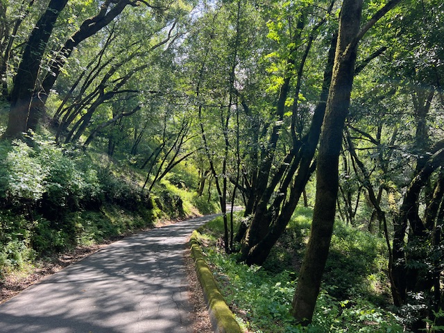
After Lunardi’s we escaped streets for quite a distance by taking the San Andreas Trail and then the Sawyer Camp Trail. This is really the beginning of the nicest part of this route, from Lunardi’s all the way down to Stanford. Back in the day we avoided the Sawyer Camp Trail because complaints about cyclists forced the park to establish and enforce a speed limit for cyclists. It was something ludicrously low, like 8 miles an hour. Essentially they were telling cyclists not to use the trail. I recall rangers using radar guns to ticket cyclists. Instead we used the streets parallel to I-280 and even at one point used I-280, entering on one ramp and immediately exiting at the next. This was illegal at the time but the only other option was a really arduous diversion. Eventually it was made legal for cyclists to use that section of highway because there was no comparable substitute byway. Now the speed limit is up to 15 MPH–pretty standard for MUPs and we’re back to riding on it.

As convenient as these trails are—they are ‘trails’ only in name since they are fully paved–they are really just multi-use paths and are well used by walkers and many other cyclists making for ‘interesting’ encounters. Although 8 miles an hour may seem very slow there are numerous tight bends with awful sightlines where it actually makes sense to cool your jets. This day it was very busy with day hikers and families out enjoying the fine, sunny weather. I didn’t mind going slowly since that was my theme for the day and it was great for the trails to finally be open again. After the storms of 2023 both trails were severely damaged and only up until a month or so ago for them to reopened after all the repairs, fire mitigation, and utility restoration.

From the Crystal Springs Dam it was a hop, skip, and jump down Cañada Road to Roberts for lunch. Nancy was telling me she’d like to come down here more often to ride. It’s not that hard actually: just take BART to Millbrae and ride up (well, really up!) to the Sawyer Camp Trail and skip all the traffic. Or, skip the short yet horrendous climb from Millbrae up to the trail by taking Caltrain further down and taking one of the more gentle climbs up to Crystal Springs.

Whether it was due to anxiety, copious rehydrating, the lack of heat, or age, my bladder was having a field day and I was having to stop to pee whenever the opportunity arose and even a few times when there was no ‘opportunity’. I peed no less than 11 times on the ride. Unlike in 2014 my ride mates were regrouping often so I was always able to catch up.

Rolling down Cañada Road is always a delight. It’s long, rolling, and has no development to ruin the attractive views of the reservoir and the surrounding hills. Although the Filoli estate fronts on the road, all the buildings are set so far back that you’re in no danger of suffering a Dynasty flashback. The end point is central Woodside and the lunch stop at Robert’s. As usual for a weekend the intersection was a mishmosh of every kind of vehicle trying to horn its way through the four-way stop. Horns ablazing. It’s also like some faux bro version of an Amsterdam intersection with hordes of cyclists in MAAP, Pas Normal, and Rapha kit on their Cervelos, Pinas, and Tarmacs parading and preening on their way to the next Strava segment. We parked in the shade to woof down some grub. Deterred by the long deli line, I made the mistake of grabbing a “chicken teriyaki” bowl. Protein, rice, veggies—what could be wrong? Plenty it turns out: the brown rice wasn’t completely cooked, the chicken was dry, the veggies were raw, and the teriyaki sauce dauntingly cloying. Ah, fuel for the body but not the soul.

By now it was bright sunshine although not overly warm at all. I was still in my windbreaker but it was soon to come off. Once over Sand Hill we dropped to Foothill Expressway for the long leg down to Los Altos. Despite being a major thoroughfare in the middle of the Midpeninsula, Foothill never feels like you’re just a mote in Cartown USA. The shoulder is wide, the traffic usually fast but not scary fast, and not very busy at all. You can get rolling very fast on Foothill—it almost encourages you to pedal faster. But not today—I was still in survival mode and riding well within my limits. David and Alan were pushing faster but I didn’t want to risk cramps. On one of the rollers David slowed down and I could see he was flagging. Considering how little he has ridden it’s praiseworthy that he made it this far and as fast as he did. I paced him for a while but then he surged ahead.

We headed up to Stevens Canyon Reservoir and we were out of the suburbs temporarily and into the foothills, strangely quiet given how close we were to the center of Silicon Valley. Even the car traffic dwindled. After a pit stop at the reservoir Nancy waved me ahead and that was the last I saw of her. A few minutes later I looked back and didn’t see her at all. Hmm, she must really be slowing down, I thought. Ahead was the last hill, Mt. Eden. It’s by Midpeninsula standards just a moderate climb, maybe a mile or two long and no more than 6-7% at times. At the top the view of the Santa Clara Valley was a nice reward. We waited for Nancy. And waited and waited. Flagging down cyclists coming up the hill we asked if they had seen her. Nope. Hmm, could she have taken a wrong turn? After a long wait, repeated phone calls and texts and no reply we were getting concerned. But being pretty tired we were no mood to launch a search party and backtrack. Go up Mt. Eden a second time? Nope! It was starting to get late anyway so we hoped Nancy would figure it all out and make it to Caltrain somehow.

The descent down Mt. Eden I’ve done only a few times, all of them a long time ago. It’s curvy and a bit bumpy with enough gradient to make it dangerous (or at least dangerous for an old fart like me). I took it easy. Alan and David dropped me immediately. Well, my Garmin was holding up much better than the POS I had 11 years ago with battery still at 87%. So I’d make it to the Los Gatos Coffee Roastery by GPS if necessary.

It was back to suburbia. David and Alan were waiting for me at the bottom. This section was actually mega-ugly but maybe I felt that way only because I was tired and wanted refreshment (= caffeine) immediately. Downtown Los Gatos was another moshpit of cars, day trippers, and bikes all slowing to a literal crawl. Now, why do I live in the Bay Area?? Sitting down for some java and potato chips was just the break I needed. Taking stock we were overall in good shape. Alan of course was fine; David and I despite our trepidations and physical issues were not suffering at all. The legs were a little tired but our spirits were still up.

The last segment of SF to SJ is a flat ride of about six or seven miles from Los Gatos to Caltrain most of it along Los Gatos Creek. The good news is that the multi-use path gets you away from the interminable cars, stop lights, and busy traffic. The bad news is that the path is well used on weekends by every form of alien life—kids on e-motos, clueless peds, Lime scooters—you name it. The path is also quite curvy and spine-tinglingly narrow at times especially when it dips below the many overpasses. During winter storms I’m sure the path is flooded and unusable as we were almost down to creek level at times. David and Alan rushed ahead and I did my best not to collide with the ‘wildlife’ peppering the path.

We exited the trail in the Willow Glen neighborhood. The tradition is to stop for frozen yogurt but it all depends on the timing of the next Caltrain departure. It was 5 o’clock and the next train was at 5:26, so we forwent the treat and headed to Ron Diridon. We made it with a few minutes to spare. By now we were about an hour behind my planned schedule of about a ten mile per hour average for the day. But overall it had been a chill day, so no worries or complaints.

David was delighted he had done the whole route on such little training; I was relieved I didn’t have a crisis; and Alan looked fresh as a daisy. In fact, the next day he was set to do a 90-mile ride in preparation for ALC. Talk about hardcore!

This was my first experience on the new electrified Caltrain. The bike cars are also improved. In contrast to BART the ride is smooth and quiet rather than rickety and ear-splitting. (Ear plugs are de rigueur on BART!) The calm was deeply appreciated. While heading back to SF we finally got word from Nancy. She indeed had taken a wrong turn and ended going up Redwood Gulch before giving up and backtracking. If you’re not familiar with Redwood Gulch, it’s a beautiful climb up to Highway 9. But it also hits 15% or more, i.e. it’s hella steep. She got bonus climbing points as then she had to go up Mt. Eden. I was relieved she was okay as the worst fantasies of her lying in a ditch somewhere had popped into my head during her long radio silence.

I deboarded at Millbrae to transfer to BART to get home. After two prolonged transfer stops, Balboa Park and 19th Street, I finally made it to Orinda at 7:50 PM. A two-and-a-half hour commute home. The fact that I was able to do this ride multimodally and not use a car was the plus; the lengthy commutes were the minus. It had been a 13-hour day on the road. But to my relief and self-confidence I did the whole thing rather painlessly by sticking to my game plan and came out the other end none the worse for wear. Next stop: one hundred miles.

Postscript: I live in fear of painful nocturnal leg cramps after a hard ride. But this time other than some minor foot cramps I had no sequelae. David, on the other hand, related to me the next day that he woke up screaming in the night with leg cramps. Ah, no pain, no gain. We’re pedaling off into our old age creaking, complaining, and gnashing our teeth. But we are still pedaling!

Postscript 2: I spoke with Nancy after posting this account and got more details on what happened to her. She went pretty far up Redwood Gulch to the point where she had to walk her bike, where she then gave up and turned around. I know exactly where that is: there is a point where the gradient on Redwood gets stupidly steep, at least 17%. And it feels like it! Although turning around was a right thing to do, if she had continued it would have flattened some and Redwood Gulch then intersects Highway 9. From there it would have been a descent to Saratoga and she would then have been back on route. However when she turned around and got to the “bottom”, she turned left to continue up Stevens Creek, which was the wrong way. Stevens Creek eventually dead-ends at a dirt trail. At that point she was at a loss what to do. Luckily she ran into another cyclist who was able to take her back to the Mt. Eden Rd. intersection where she continued on route. Those two wrong turns were not only debilitating but long. She made it to Caltrain and just missed the train. Rather than wait she rode to BART and took it to SF. She got home after 10 PM! So Nancy takes the award for Most Miserably Long Multimodal Mishegas. Oh, and she didn’t get dinner until she got home.

Ride Recap: April Jersey and Short & Sassy

April 2025 Jersey Ride and Short & Sassy riders

The monthly JR and the Short & Sassy Tib loop took place without any drama. At the last minute Roger and I decided to do an East Bay Tiburon Loop and meet everyone at Woodlands Market. From what we could tell it looked like the entire central Bay Area had clear, beautiful blue skies and bright sunshine. It was slightly cool but it warmed up nicely by the time we were eating lunch at Woodlands. The JR consisted of David Go.; Chris, the ride leader, leading his very first Different Spokes ride; and Roger S. The Short & Sassy were Ginny, Nancy, Cathy, and newer member Michelle.

According to Chris their groups had an uneventful ride to Tiburon with David Go. and Nancy deciding to lead the pack into town. David had abandoned the JR years ago as he too had had his fill of the lemming race across the Golden Gate Bridge and instead has been doing the S&S. Now he’s back to doing the JR presumably because he’s interested in longer rides even if they are filled with more drama and near-death experiences. Our ride across the Richmond-San Rafael Bridge was in contrast practically like crossing the desert with the almost complete lack of two-wheeled traffic. As usual we were accompanied by the deafening cacaphony from the cars hurtling westward making for a Jekyl-Hyde experience, the peaceful Bay along with the 65+ MPH urban misery in the lane to our left.

For some reason traffic heading into San Rafael was very heavy and slow. No one was turning into San Quentin so it must not have been visitation causing the crowding. Thankfully we left the other ‘prisoners’ ‘in their metal buckets to their plight when we turned south to head to the loop.

What can one say? Paradise Drive is aptly named. How fortunate to have a home in such a peaceful setting even if it does mean you can’t just walk to the corner for a take-out dinner. The cyclists were out in force and we were passed by many in both directions. Dropping into Tiburon is always welcoming: the ferry pier, beautiful lawn by the Bay, and plenty of daytrippers out enjoying the sunshine and water.

We got to Woodlands about five minutes before the others rolled in with big smiles on their faces. We were shoehorned into a table on the far side of Woodlands because the usual tables had other diners. We crowded around our table while Nancy and Michelle were relegated to the adjacent tiny kids’ table. I got a chance to chat with Ginny about her recent Spanish language immersion trip to Mexico City and how it compared to one in Spain. (It’s better to go to Mexico because they’re more patient with tongue-tied Americans than the Spanish, who immediately switch to English.) There was a long discussion of the preferred way to get out of Tiburon, either detour through Strawberry Cove or take the direct route on Tiburon Blvd. The group decided to go back on Tib Blvd.

The fair spring weather obviously brought out hordes of folks as the foot-, pedal-, and automobile traffic in Tiburon was borderline ghastly. Predictably everything jammed up at the 101 intersection and that’s where Roger took the lead to head up Horse Hill rather than go up Camino Alto for our return. The others were ahead so we bid them a telepathic adieu.

Horse Hill has been the ‘easy’ way to get to Larkspur ever since I moved to SF. It has less vertical than Camino Alto and absolutely no traffic. The devil’s bargain though is that there is short but steep 12% section. On just about any other day it wouldn’t have bothered me. But this day I was flagging and I had to put the bike in my lowest gear just to stagger up the incline. That abomination done it was literallly all downhill to Corte Madera and a nice flat ride to Larkspur.

Traffic hadn’t abated since morning so we had plenty of company on Sir Francis Drake. There are two ways to get to the bridge sidewalk, one of which involves a risky move. The designated route is to continue onto the 580, as bikes are allowed on the shoulder, and then hastily leave at the next exit. For most cyclists that’s a no-go move even if legal and recommended. The other option is to cross Sir Francis Drake to catch the bidirectional bike lane on the other side of the road. That path has a reassuringly robust and tall concrete barrier between you and the metal death buckets. But to get to it you have to cross the road at the top of the hill where there is no good sightline and cars are either accelerating to enter 580 or just exiting 580 at highway speed. Today being a heavy traffic day, we did the former. It’s merely a question of time before a cyclist is killed crossing over to catch that bike lane.

On the bridge it was the usual crawl up the long uphill. The headwind out of the Golden Gate wasn’t as strong as in past days but it was giving me a whipping regardless. Roger kindly led the way and I got a little draft.

Chris mentioned that the return trip for the rest was also uneventful and they were back in the Castro by 2 PM.

Happy April Fools Day!

The club has had at least two rides on April Fools Day, one in 1984 and another in 2012 and coincidentally they were the “same” ride–the Apple Blossom. Former club president and ChainLetter editor, Michael John, was the creator of the Sonoma Blossom ride, which then became known as the Apple Blossom and he led the first edition on this day in 1984. For the club’s 30th anniversary Roger and I led a later iteration of the Apple Blossom. That it also took place on April 1 is mere coincidence; at least I didn’t notice it until now!

The early days of the club had a prolific number of rides around the Bay Area. It was probably partly due to the club’s orientation towards biketouring that had members very willing to go beyond the San Francisco enclave and Marin. Whatever the reason it didn’t take much for a group of Spokers to get interested in a ride that involved a car drive even for what would be considered a short–20 to 30 miles–ride by today’s standards. (There are members who scoff at the idea of going to a ride that involves driving more miles than the ride has.) I think also Michael John just happened to have a rather broad knowledge of riding around the Bay Area and knew where the good and interesting stuff was. It probably all seemed like “new territory” to many members while to us it’s merely old hat.

The 1984 ride had nine participants. That’s Bob Krumm on the left, one of the founders and our first president; next to him is his boyfriend, Luis Dufau; then Scott O’Hara, then our resident porn star; Tom Crites; Jerry Basso, who died of AIDS about two years later, Jamie Moran; Richard Palmer; and finally Derek Liecty. (Michael John is not pictured because he’s taking the photo.) Luis and Jerry were unusual at the time because they were among the few who rode racing bikes and wore racing kit. As you can see most of the rest–and this was typical of rides back then–wore street clothes–gym shorts, Bermuda shorts, white athletic socks, sneakers, and in Tom Crites’s case, Levis! Luis convinced Bob to start wearing “real” cycling kit, which in those days meant wool jerseys and shorts! In the top picture you can see the kind of bikes a lot of members rode back then; they had ‘cheater’ brakes, kickstands, Pletscher racks, reflectors, and not a bit of Campy gear in sight. I do recall Jerry Basso, being Italian-American, had a celeste Bianchi road bike, which was quite unusual at the time. Also notice that no one is wearing a helmet except Richard Palmer. Helmets weren’t required on club rides until the early ’90s.

Fast forward to April 1, 2012: things have changed a bit–everyone is now wearing cycling kit and those bikes aren’t your $150 basic college bike! And everyone has a helmet.

The 2012 Apple Blossom had a good turnout as well. That’s Karry in the very front, a very early member who lapsed after getting “married”, moved to the suburbs, and had kids. He suddenly returned to do the Apple Blossom, a ride he used to lead! You can make out me, Roger S, David Go. and Roger among the rest. This ride also went to Occidental for lunch at the Union Hotel where we encountered the Occidental April Fools Day parade.

They say hippies never die–they just move to Occidental!

Ride Recap: Green, Green, New Speedway Boogie

Green, green, it’s green they say on the far side of the hill

We’ve been trying to take advantage of good weather to get out into the East Bay hills before they start to dry up and turn brown. We have not been having a wet winter despite what you may think—our rain gauge tells us we are unlikely to reach season normal this year unless we get a couple more atmospheric rivers. That’s unlikely. Despite the overall lack of rain we have been getting enough to keep the grass hills green; in dry years they would already be turning a dun color. But the signs are there that the green hills are not going to continue much longer as we discovered yesterday in our jaunt up Patterson and Altamont Passes. Those hills are still quite green despite cattle grazing them down to near nubs. But ominous brown patches are showing up indicating that certain areas are losing what precious moisture the topsoil has.

Nonetheless we had a great time. Whatever Spokers were doing yesterday it wasn’t riding with the club—Jeff’s ride to Gazos Creek had no sign-ups and just David Go. came on our ride. David is continuing his return from a year-long injury and doing rides much harder than I would venture after such a prolonged layoff. Yesterday’s ride was 37 miles and about 2,700 feet of elevation gain. However the ascent up Patterson has several stretches well above 10% making you reach for your bigger cogs. He may not have rocketed up the passes but he rode smart—spinning low gears and going steady—and did the whole thing without complaint nor feeling gassed. After coming back from Japan last November I came down with some RSV-like cough that just wouldn’t end that kept me off the bike for about six weeks. When I started to ride in January a 25-mile, flat ride just about killed me and here was David slogging up passes I wouldn’t have gone near two months ago.

Originally we were going to do this ride on Sunday but the weather forecast had turned bad, making Saturday the only chance for a weekend ride. We ended up with a mostly sunny day with just a light westerly wind in the afternoon after a cold start in Livermore.

Speaking of Livermore, doing rides from the Livermore Valley is a trend of recent origin. Back in the day most members were in or near San Francisco. However we had one active member, Kevin Anderson aka “Rex Flash, mountain biker” aka “Flo Velcro, advice columnist”, who lived out in Pleasanton and he liked to show timid Spokers from SF what life was like in east Contra Costa! He had a popular ride out to the Shadow Cliffs Regional Recreation Area just west of Livermore to enjoy the water slide. Given the ride started in Livermore, it was, uh, more an excuse to enjoy the sights at the water park than it was a workout. The water slide was a hit as well as the manly scenery. Dad bods galore! But that was about it for rides that far east.

Although there were occasional forays up Altamont Pass, riding out that way only started to take off in the Aughts with Mines Road becoming an annual ride and occasional rides up Altamont or Patterson. To my knowledge no one was taking on Corral Hollow or Del Puerto Canyon except Will or Jerome (or me). There’s good reason to avoid riding near Livermore: summer and early fall the conditions can be atrocious due to incredible heat. Being truly rural areas there are almost no services, which meant that getting in trouble—running low on water, getting a flat or worse—was serious business and having to depend on the kindness of strangers.

But when the rains come those sere, brown hills rapidly sprout grass and become a lush green paradise by early January. So the period from the New Year’s to about mid-April is the best time to ride out there.

If you have ride exclusively in urban or suburban areas, truly rural areas can be a shock to your system but in a good way. Although you still have to contend with occasional cars, it’s not at all like riding in the suburbs—rural roads have little traffic. Yes, there isn’t much in the way of amenities and you’re left to your own devices but the absence of other humans is very calming!

A convenient place to start a ride in the Livermore Valley is the Ernie Rodrigues Softball Fields. It has a huge parking lot and a restroom. It’s also right at the southern edge of Livermore where the vineyards begin, so it’s easy to take off to Mines, Patterson, Tesla/Corral Hollow, and even Altamont. Yesterday morning it was a crisp 50F at the start and we were bundled up even though we knew that literally within four miles we’d be climbing. We could see a few of the gigantic wind turbines spinning up Altamont in the distance, so we knew there was a wind. But we really couldn’t feel it (yet). It was well before the winery traffic started up so it was quiet and only other cyclists, runners, and dog walkers were up and about. The climb to Patterson is actually two climbs, the first of which is up Cross Road and quite steady and of only moderate difficulty. After a short but fast descent you then get on Patterson Pass Road and the grade gets serious. But it’s not continuous with just two or three humps that get into the double digits. The last one is just before the top. Around the last curve is “Top of the World”, an impressive vista point of the Sacramento Valley. On a good day the snow covered Sierras are visible in the distance. Alas, we weren’t lucky this time. But the view of the Valley always impresses especially given the hills are devoid of development other than wind turbines and power lines. This was a decision point for David—turn back if tired or commit to doing the whole shebang. He was feeling pretty good despite the effort, so onward.

The descent to Tracy is serious if fun. It’s fast. The road is uncluttered and most of the time the sightlines are good. But the pavement varies from egregious heaves to typical county chipseal. You hardly have to pedal at all yet the gradient isn’t so steep that you’re made nervous—you can just let it all hang out. There is one left curve that has huge warning signs with a 20 MPH limit. I imagine that more than one car has flown off the road there forcing the county to put up the warnings. David flew off into the distance while Roger and I kept a more conservative pace descending.

Once you’re at the western edge of Tracy traffic can be pretty bad. Logistics centers for Amazon, Costco, Safeway and probably others as well as depot areas for Tesla, Toyota, and other car manufacturers mean that big trucks rule the roads. There is an oasis: a Valero gas station with a Subway, a taqueria, and of course the obligatory Grab ’n Go gas station shop to get food and drinks. There used to be a Wienerschnitzel too but it decamped for a more central Tracy location. David was already munching on his gluten-free snacks when we arrived. The taqueria was doing land office business. I wanted to check out the fried chicken in the Grab ’N Go, which by the way is stocked with a crapton of fast food—various kinds of fried chicken, taquitos, sandwiches, bagels, packaged salads—as well as the usual convenience “foods”. You are not going to starve here unless you’re a food snob. In the end I grabbed a chicken salad sandwich that I could split with Roger since he wasn’t in the mood for fried food. I so wanted to eat fried chicken! But I admit the thought of having to taste it a second time up Altamont had me choose more wisely. Another time, alas.

To escape the trucks and the boring arterials in west Tracy the solution is to use the California Aqueduct Bikeway. Hardly anyone knows that long sections of the California Aqueduct have service roads that are open to cyclists. There’s no traffic, you’re by the water, and for some reason there aren’t a zillion homeless people living on it. In fact, I haven’t ever seen any homeless camps along the Aqueduct. For a few miles you can have a pleasant roll until you get to Altamont Pass Road. The wind can be daunting at times but today it was mild.

Altamont Pass Road is scary for the first half-mile because it’s essentially a long entrance ramp for I-580. Cars and trucks out of Tracy zoom by in a hurry to get to the freeway. Once past that motor vehicle hell we were mostly by ourselves on Altamont, which climbs at a gentle rate. There isn’t anything out there except ranches, a Waste Management landfill, and the Summit Garage. How can a auto repair business survive in the middle of nowhere? It’s like something out of “Bagdad Café”. One awful change since we were here last is that the county has put in a rumble strip on the shoulder. This totally sucks for cyclists as long sections of the shoulder are now unrideable forcing you into the roadway proper. In certain sections it looks like the county has made an effort to extend the shoulder by paving more to the right, allowing cyclists some escape. But in other sections the rumble strip takes up the entirety of the shoulder. Even though it is legal for cyclists to use the lane, on Altamont Pass cars often speed by making the experience a bit nerve-racking when you know they’re approaching. We hopped over the rumble strip back-and-forth when cars came by.

To return to Livermore you can head straight down Altamont or turn and cross over I-580. We did the latter since it’s nicer plus we’d escape the rumble strip. However like Bear Creek Road or Pinehurst Road near Orinda, that section of Flynn Road has become a massive illegal dumping ground. We saw the usual household items—sofas, love chairs, TVs, refrigerators—as well as constuction and building materials such as roofing shingles in huge piles all the way to the top of Flynn. Like attracts like, so it won’t be long until it all looks like something you’d see at the nearby Waste Management dumpsite. Just lovely!

However the intensely green hills, luckily, paints over that ugliness. At the top we took a breather and enjoyed the view. We could see large patches of purple flowers up on the hillsides—lupine, or perhaps echium? There were a few poppies starting to appear but their heyday is probably a couple of weeks away.

The descent was easy and fast into Livermore and then it was just one little hill before we were back on Tesla Road. The wineries were now fully awake and traffic was heavier but by no means terrible. Back at Ernie Rodriques David was still chipper no less the wear after some serious climbing and long day in the saddle. What a fabulous day to visit the green hills!